Tropical Storm Isaias Spreading Threats of Damaging Winds, Flooding Rain and Tornadoes to Mid-Atlantic and Northeast
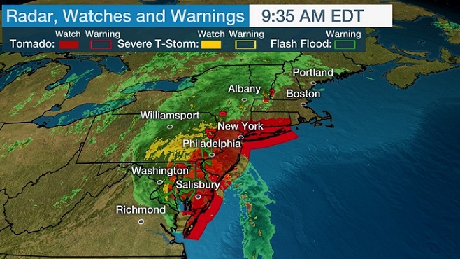
Tropical Storm Isaias (ees-ah-EE-ahs) will race northward near the East Coast through late Tuesday with damaging winds, flooding rainfall and tornadoes. Isaias is now centered over southeast Virginia and is moving to the north-northeast at 30 to 35 mph. Strong winds are ongoing from eastern North Carolina to the Jersey Shore. Manteo, North Carolina, Norfolk, Virginia, and Salisbury, Maryland, have all clocked wind gusts over 60 mph this morning. The National Hurricane Center reports that a wind gust to 94 mph was measured at a weather station at York River East, Virginia.
Tropical storm warnings are in effect from the mid-Atlantic to coastal Maine, including Washington, D.C., Philadelphia, New York City and Boston. Isaias will quickly move through the Northeast today and should be in eastern Canada by early tomorrow morning. There will be power outages and tree damage in locations that experience stronger wind gusts along the East Coast. This includes areas from eastern North Carolina to the coastal mid-Atlantic, New York City, Long Island and parts of New England.
Isaias has the potential to produce the following rainfall totals as it moves northward, according to the National Hurricane Center.
We recognize the severe impact that current conditions are having on our customers and we are committed to restoring service levels as quickly as possible. As a result of these weather issues, the ALG Client Service Team will send daily updates as we monitor the progress and track job level impact.