Storm Prompts Sierra Blizzard Warnings Where Up To 12 Feet of Snow Could Fall
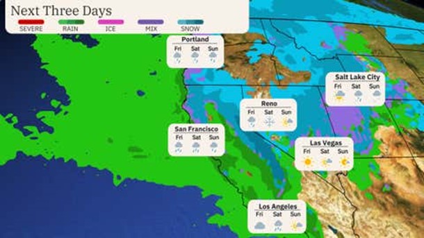
A powerful Pacific storm pushing through the West Coast. It will bring low-elevation rain and mountain snow to much of the Northwest and northern Rockies. But its most severe impacts are likely in California's Sierra Nevada mountains. Blizzard conditions are likely, and accumulations will be measured in multiple feet in the Sierra. This will be their heaviest snowstorm since about this time last year.
Blizzard warnings have been issued in the northern and central Sierra, including Lake Tahoe, and for eastern Nevada through Sunday morning. Winter storm warnings for snow and high winds are also in effect for other parts of Northern California, the Cascades and western Nevada, including Reno. According to NWS-Reno, snowfall rates could reach 3 to 5 inches per hour, at times. The severe winter conditions will impact travel on stretches of Interstates 5 and 80 as well as U.S. 50, leading to closures.
Heavy snow will be this storm's primary calling card. However, one-inch-plus rainfall totals are expected at elevations too warm for snow, primarily in Northern California but also in parts of Southern California.
This could lead to isolated flooding of typical urban trouble spots (freeway exit ramps, for example) but also could lead to some slides and debris flows given soggy ground from recent rainfall.
We recognize the severe impact that current conditions are having on our customers, and we are committed to restoring service levels as quickly as possible. As a result of these weather issues, the ALG Client Service Team will send daily updates as we monitor the progress and track job level impact.